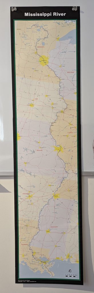
Here is a roll map for the Mississippi River. It’s not the greatest layout. I needed to finish in a hurry. Hopefully I’ll get some time in the future to clean this up a bit. Lots of of labels need to be better placed. The map is 12″x48″ layout. If you resize this, the fine details will start to get messed up.
I encourage constructive feedback (like I didn’t add ND cities, label Canada, cool points of interest, etc).
I printed this on 11×17 paper using the “Poster” function of the Windows print dialog. From there I bumped up the overlap (I recommend 0.25″ to 0.5″). Turn the cut marks on. I used a ruler and an X-Acto to cut the bottom edge off each sheet. Then line up and tape each section in the white margins. After taping, flip it upside down and on the edge of a table (square edge works best). Use a glue stick where it will overlap and then carefully fold it back. After drying, use a ruler and knife to cut off all the white excess.
You can download it here: Mississippi River Map (46.6 MB)